
Barrier-Free Navigation through the City
Dieser Artikel ist älter als ein Jahr!
An Austrian project has set out to make travel with public transportation significantly easier for people with special needs. Universities, research institutions and transport providers are working to develop a smartphone-based navigation system under the name Ways4all that can guide visually-impaired persons, for example, safely and conveniently through the city. The system is to be tested at the new Vienna Central Station starting in October.
© Bild: FH Joanneum
© Bild: FH Joanneum
© Bild: FH Joanneum
© Bild: FH Joanneum
© Bild: FH Joanneum
© Bild: FH Joanneum
© Bild: FH Joanneum
© Bild: FH Joanneum
© Bild: FH Joanneum
From route planning to the destination
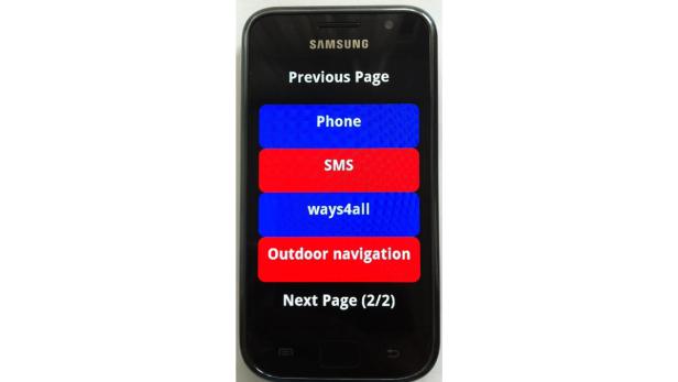
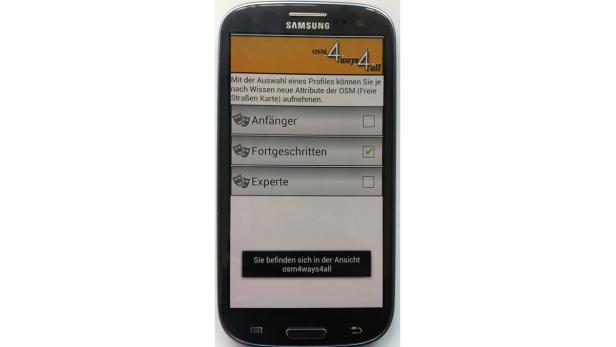
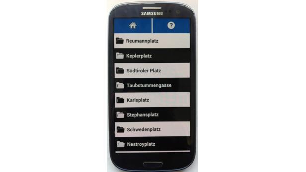
Ways4all consists of four projects that together will result in a complete solution. The first covers the creation of a user interface on Android smartphones. This uses the integrated text-to-speech functions to navigate through a specially designed, list-based menu. Here, the user enters a destination for a day trip for example; there are a number of different possibilities for this that must be tested. Gesture control, handwriting recognition or a simplified touch keyboard with multiple number and letter maps are just some of the options.
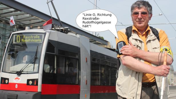
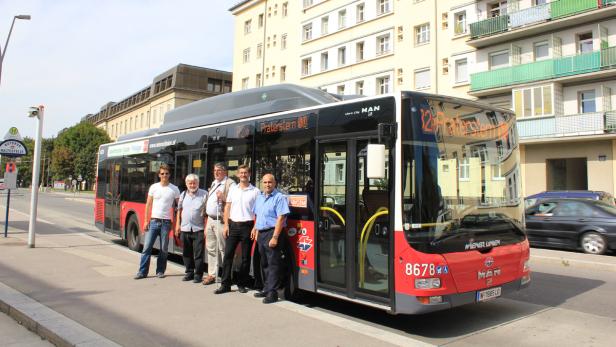
Once the route has been selected, the user goes outside, where he or she is then guided to a bus stop by means of GPS and turn-by-turn directions. While the user waits at the stop, the smartphone connects with the bus automatically by WIFI to tell the driver that a passenger wants to board. If there are buses from different lines at the stop, the smartphone guides the user to the bus that matches the selected route.
RFID sensors in the guidance system
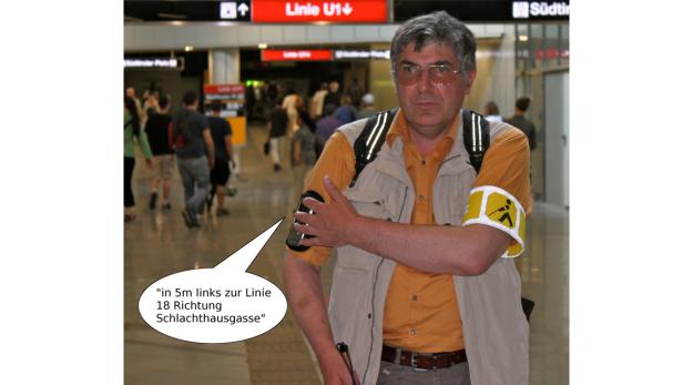
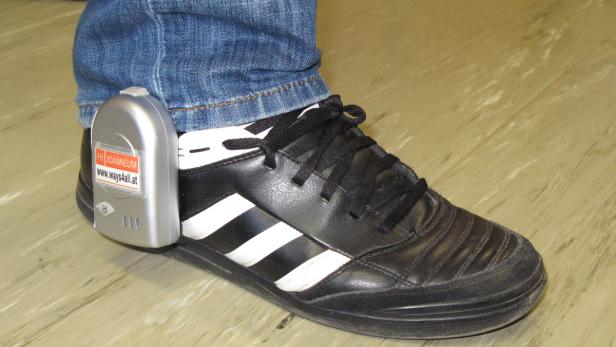
The bus then brings the user to the metro station at Vienna Central Station, for example. From there, the smartphone guides the user to a tactile guidance system. RFID chips are embedded in the tactile paving on the floor and connect with an RFID sensor on the user`s shoe. The sensors and building plans that are saved on the Ways4all server are then used to enable people to navigate indoors without GPS.
The RFID coverage, which will actually be operating at Vienna Central Station starting in October, is to be so complete that a user cannot get lost. If the user is familiar with the area, the Ways4all app can also simply be used to identify his or her exact location at any given time.
Community expanding OpenStreetMap
Ways4all uses OpenStreetMap for its map material. According to project director Werner Bischof, community members can contribute improvements to the maps as they move through the city, thereby helping other users. A visually impaired Ways4all user can record his or her route, for example, and enter and upload special attributes. Project team members then check the data for errors, complete any necessary processing, and add the information to the database. Then, the route will be available to all users including all the associated tips and hazards.
When planning a route, Ways4all also takes current changes, obstacles and personal abilities into account. Different routes are selected for people who can walk and people in wheelchairs, a user is guided to the elevator when an escalator is not working, and users are guided around blocked paths or sidewalks.
Ways4all also integrates an existing assistance system for visually impaired people: POPTIS. This app, which was created by associations for the blind and the Federal Ministry for Transport, Innovation and Technology, describes all paths in the Vienna metro network. POPTIS users can listen to these descriptions as MP3 files as they navigate.
Presentation at the ITS World Congress
Ways4all will be introduced to the public at the ITS World Congress in Vienna from October 22 to 26. Public agencies, associations and other interested parties will be given special tours from the exhibition grounds to Vienna Central Station to see the system in actual use.
The Ways4all project was launched in 2008. It is being managed by Joanneum University of Applied Sciences; the list of project partners includes Graz University of Technology, Salzburg Research, digital concepts, BAUM Audiodata, Hilfsgemeinschaft, Österreichische Blindenwohlfahrt, Österreichischer Blinden- und Sehbehindertenverband, Österreichische Arbeitsgemeinschaft für Rehabilitation, SPI Intelligence Services and Transelektronik. Ways4all is being funded by the Federal Ministry for Transport, Innovation and Technology, Austrian Railways and the Vienna Transport Authority.
The latter two transport providers want to permanently integrate the system in their networks, but the system must first prove itself.
Kommentare