“OpenStreetMap has won the race”
Dieser Artikel ist älter als ein Jahr!
A new record was broken: The millionth OpenStreetMap user registered. Pascal Neis, a programmer and active OpenStreetMap user who lives in Germany, keeps track of the number of users in the free map community. "Since members are regularly deleted because of spam but the IDs for the users are still counted, we can`t say exactly who the millionth user was," explained Neis in an interview with futurezone. This is quite an achievement for the crowdsourcing project that was launched by Steve Coast in July 2004, since it only had around 585,000 actively contributing users in April 2012.
Neis has collected other data about OpenStreetMap users, as well, because what counts in practice is not so much the number of registered users as the number of users who actively make entries to improve the maps. A large share of the active users is in Europe, as can be seen when comparing the two maps that Neis has prepared. It is especially noteworthy to see that aside from the community in Germany, the group in Austria is also very active.

© Pascal Neis
Austria: up to 900 active users per month
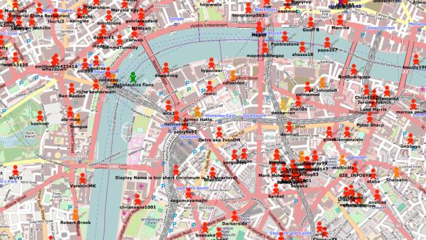
"In Austria, around 10,000 different members had made at least one change to the data by the end of 2012," Neis quoted from his current calculations, which he completed at the request of futurezone after the million mark was passed. "At the end of the year, an average of up to 900 members had made contributions to the maps each month. The number of active members per day in Austria is between 50 and 80. And four to six new members join every day," said Neis, who also recently created an interactive map that shows the individual contributors to the OpenStreetMap community. This map also shows who has added how much to the free map.
The active mappers enter buildings, street addresses, trees, bicycle paths, hiking trails and bathroom facilities on the map to improve it (futurezone already reported about "
In rural areas, Labres said that a lot depends on whether or not there are so-called local heroes. "A lot depends on the desire and commitment of the individual members. Some take care of their home town, while others like to climb mountains and track the hiking trails and routes, which can yield very detailed data," explained the mapper, who is also a member of the board of directors of the association OpenStreetMap Austria. The free map is also being used by the Vösendorf volunteer fire department, which recorded all hydrants in its town, Labres explained. The Lanzendorf volunteer fire department also uses OpenStreetMap as an "OpenFireMap".
Google helped OpenStreetMap become successful
The year 2012 was the "year of the free map." Almost a year ago, Google started charging fees when too many queries were received by the programming interface of the Google Maps service. As a result, the "Wikipedia of maps" began to increasingly compete with Google Maps. After Foursquare and Apple, Wikipedia also switched to OpenStreetMap in its apps. "OpenStreetMap has clearly won the race against commercial map publishers. However, these publishers still hold special niches that OpenStreetMap will not cover for a long time," said Helge Fahrnberger, co-founder of the startup Toursprung, which offers apps and maps on the Internet that are based on OpenStreetMap data.
"Many of our tourist customers and also national and regional tourism associations have recognized the importance of OpenStreetMap and are now investing in improving the quality of the data, either by advertising the free maps, by lobbying for the release of government data, or by assigning interns to close certain gaps," Fahrnberger said. "The switch to OpenStreetMap was an important step for us. Now, we can also offer printed maps with a resolution of up to 600 dpi, and maps for offline use in apps," Fahrnberger explained. The most frequently used platform from Toursprung, Bikemap.net, had 1.2 million unique visitors per month last summer. Here, however, fans of the (well known) Google images can switch to the Google satellite view.
In addition to the hydrant maps for the fire department and biking and hiking maps, OpenStreetMap data can also be used for many other applications. "We are currently developing a bicycle routing algorithm on the basis of OpenStreetMap for the German state of Lower Saxony. It will work in all of Europe, and will be launched at the beginning of March," Fahrnberger said. The work of the million plus OpenStreetMap users who voluntarily contribute to the project definitely pays off in the numerous uses that have already been found for this information.
Kommentare